
Context: National Aeronautics and Space Administration (NASA) and the Indian Space Research Organization (ISRO) have jointly manufactured an earth science satellite named, NISAR (NASA-ISRO Synthetic Aperture Radar) at a cost of about Rs 470 crore.
About NISAR
- It is an Earth-observation satellite expected to be launched in January 2024 from Satish Dhawan Space Centre in Andhra Pradesh into a near-polar orbit.
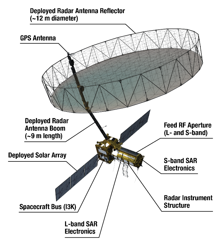
Features
- The 2,800 kilograms satellite consists of both L-band and S-band synthetic aperture radar (SAR) instruments, which makes it a dual-frequencyimaging radar satellite. SAR is capable of penetrating clouds and can collect data day and night regardless of the weather conditions.
- L-band SAR operates at a frequency of around 1 to 2 GHz. The lower frequency (higher wavelength) of L-band SAR allows it to penetrate through vegetation and soil, making it useful for monitoring changes in forest cover, soil moisture etc.
- S-band SAR operates at a frequency of around 2 to 4 GHz. S-band SAR has a higher resolution than L-band SAR and is typically used for applications where higher detail is required, such as monitoring changes in urban areas or coastal zones.
- It has a large 39-foot stationary antenna reflector made of a gold-plated wire mesh which will be used to focus the radar signals emitted and received by the upward-facing feed on the instrument structure.
- The spacecraft will orbit the Earth in a sun-synchronous orbit of 747 Km with an inclination of 98.4 degrees for a 12-day repeat cycle.
Utility
- Study Earth’s dynamic land and ice surfaces in greater detail and observe subtle changes in Earth’s surfaces. E.g., Track flow rates of glaciers and ice sheets, landslide-prone areas and changes in the coastline etc.
- Spot warning signs of natural disasters, such as volcanic eruptions, earthquakes and landslides.
- Measure groundwater levels, agricultural mapping, natural resource mapping and monitor Earth’s forest and agricultural regions to improve understanding of carbon exchange.